South Carolina: The Pacolet River - Union & Cherokee Counties
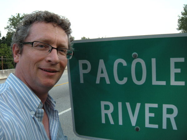
Taken at my first visit to the Pacolet River Bridge.

A brief history of Grindal Shoals’ place in the world that was.
In the 1620s, the King of England liked to see his ventures in the New World make money or at least pay for themselves. In Canada we are most familiar with the Hudson’s Bay Company which played a significant role in populating and financing development in most of what became Western Canada through fur trading with the First Nations. But that came many years later after several failed experiments in the Americas. Carolana – the area that became the two Carolinas and northern Georgia, was also first chartered to a company of ‘Proprietors’ to try to create something sustainable. They didn’t succeed.
It took a while for things to work out but eventually settlements were able to produce crops that could sustain a colony. While successful crops were not the same as the ones further north -grains and tobacco- what did flourish in the marshes of coastal Carolana was rice and indigo. Eventually these crops made the Carolina colony and especially Charles Town one of the richest areas in the Empire.
To work the crops slaves were imported from Africa and from the sugar colonies of the West Indies. Later after the cotton gin made cotton a commercially profitable crop across nearly all of the South, many more slaves were brought in. At its height there are thought to have been 4 million slaves in America.
Settlement in the back country was encouraged because, although services and infrastructure were practically non existent, settlement made the area easier to defend from outside attack. Having a white population inland created a buffer from marauding Indians, made the region more defend-able from invasion from Spanish Florida and made it harder for slave to successfully runaway.
An ancient Indian trail at the foot of the blue ridge mountains near the headwaters of what would become large rivers, but where those rivers were still small and river crossings were easier led to the development of the great wagon road from Philadelphia south to the Carolinas and into Georgia. This road passed right through western Maryland. This path was the way many families “went west” -including those clustered around the Henderson land grant. That included the Jasper family that provided the motivation for John Foster and his wife Mary MacElfresh Foster, sister to Susannah MacElfresh Jasper, to travel south during the revolution and upon peace, settle at Gridal Shoals.
Transportation and topography made Grindal Shoals significant. First its proximity to to great wagon road, made it accessible to many. Plus the slate rock river bed present at the shoal made it a place the Pacolet river could be forded. Indeed the fist name of the spot was Grindal’s Ford after the Grindal family who settled it.
Because the river could be crossed roads lead to and from the shoal and the area became a travel route. The Pacolet runs to the Broad River and eventually to the Atlantic and in those days the Pacolet carried enough water for boat travel to the sea making Grindal Shoals a transportation hub.
When war the war for Independence from the British came, the British put a lot of stock in the fact land grants in the south were more recent and perhaps grantees would be more loyal as a result. They also saw how profitable the South had become and so there was a special effort put into conquering the South and possibly holding onto it. For the Patriot farmers and the small contininent of Continental Army regulars left to defend the south, a place like Grindal Shoals where an army could manoeuvre and the ability to see great distances from the gravelly hillock at the north side of the river gave the site strategic advantages that General Daniel Morgan and others took full advantage of. Morgan famously made the area his headquarters while recruiting militia for the battle he knew was coming and that happened at Cowpens.
By the mid 1880s, with Independence won the region prospered in its way with subsistence farming leading the way. There were grist mills, blacksmiths and stillers all present in the area around Sandy Run where the Fosters lived. Unionville was a little further off.
The 1860s brought the War Between the States and while no battles were fought in the upcountry of South Carolina as there had been battles during the Revolution, very few families were spared the loss of young men and all knew the privations of rationed foods and goods. The loss of the war and the economic upheaval created by emancipation and the failed policies of Reconstruction following the assassination of Lincoln, took a deep toll on this whole region. 1860s also brought the railroad and when the tracks were laid to Jonesville by-passing Grindal Shoals, the end of an era for Grindal Shoals was reached.
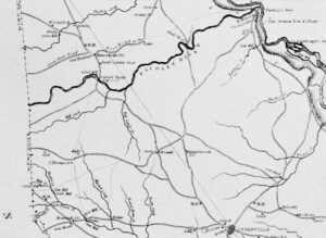
Mills map
My copy is signed by Robert Ivey and John Robertson on the occasion of my first visit to Grindal Shoals.
https://www.rootsandrecall.com/union/buildings/mills-map-of-union-county-ca-1825/
Horsehoe Robertson
Lorem Ipsum is simply dummy text of the printing and typesetting industry. Lorem Ipsum has been the industry’s standard dummy text ever since the 1500s, when an unknown printer took a galley of type and scrambled it to make a type specimen book. It has survived not only five centuries, but also the leap into electronic typesetting, remaining essentially unchanged.


History of Grindal Shoals


Grindal Shoals Gazette

